 Tally Wild
Multispectral drone crop analysis
A multispectral camera sees light the eye can't, including near-infrared, and turns it into a crop health map of every acre. Use it to count stands and decide where to replant, build a spray map so product goes only where it's needed, and record storm or flood damage for your insurance claim.
Free. See the three closest pilots and message one. Drone pilot? Get on the map.
What a crop health map does for you
Healthy plants reflect near-infrared light strongly. Stressed plants reflect less, often before you'd notice from the road. A drone flight measures that across the whole field, so you scout the right spots instead of walking a few rows and hoping they represent the rest.
Find problems early
The map shows where plants are stressed by weeds, disease, insects, water or nutrients. University of Minnesota researchers used it to find soybean aphid stress from a drone.
Scout where it matters
Walk straight to the yellow and red zones instead of zig-zagging the field. A crop scout often looks at less than one plant per acre; the drone sees them all.
Prescription spray maps
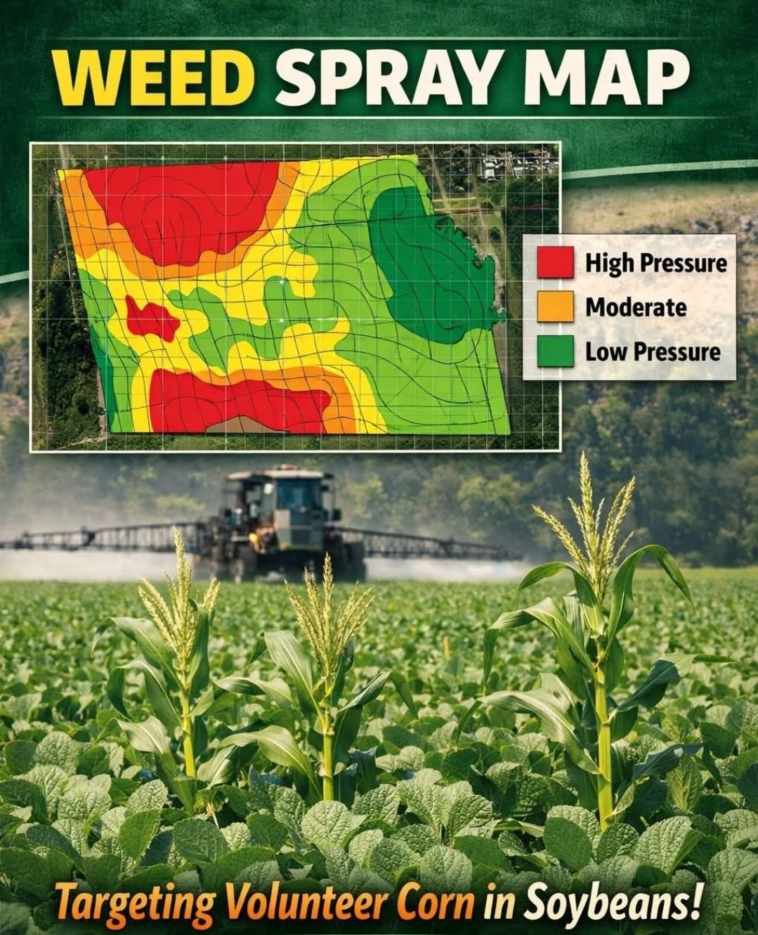
The map becomes a prescription you load into a variable-rate sprayer or spray drone, so you spray the problem areas and skip the clean ones.
Stand counts on every acre
Count emerged plants across the whole field, not four or five hand-counted spots, and see exactly where stands are thin.
Replant only what needs it
Replant the weak areas instead of the whole field, and keep the good stand you already paid for.
Storm and flood records
Dated, mapped imagery shows where hail, wind or water hit and how much of the field it covers, to support an insurance claim.
Why growers use it
Crop analysis pays when it changes a decision: where to spray, where to replant and what to document. These numbers come from university work.
less product when a drone weed map told the sprayer where to go in an Iowa State demonstration: about $13.42 an acre saved, with weed control and yield matching a broadcast pass.
Iowa State University Extension, 2024is the usual hand stand count: 17 ft 5 in of 30-inch row (1/1000 acre) counted in a few places and multiplied out for the whole field. A drone counts the whole field.
University of Nebraska CropWatch, 2025is the window to report crop damage to your insurance agent after you find it. Document the damage, and don't destroy or replant until the adjuster says so.
NC State Extension, 2024From flight to field decisions
Find a pilot
Search your zip code on the map and message a pilot about your fields, crop and what you want to know.
Fly the field
The drone flies set lines with a multispectral camera, usually around midday in steady light.
Make the maps
The flight becomes a crop health map, stand counts and problem zones, all tied to GPS.
Act on it
Scout the flagged zones, load a prescription into your sprayer, replant thin areas or send the maps to your insurance adjuster.
Common crop analysis maps and files
- Crop health (NDVI and similar) maps of the whole field
- Stand counts and stand maps after emergence, with thin areas outlined
- Variable-rate and spot-spray prescription files for your sprayer or a spray drone
- Weed patch maps before canopy closure
- Storm, hail, wind and flood damage maps with dates and acres affected
- Before-and-after maps to compare a treatment, a hybrid or a drainage fix
- Files that open in common farm software and GIS
Crop analysis pilots near you
Pilots on the map who offer multispectral crop analysis fly corn, soybeans, wheat, hay and specialty crops. Search for pilots in Ohio, Kentucky, West Virginia, Indiana, Wisconsin and Virginia and across the US.
Crop analysis questions
What is a multispectral drone?
A drone carrying a camera that records several bands of light, including red, red edge and near-infrared. Software combines them into crop health maps like NDVI that show plant vigor across the field.
Can a drone map find problems before I can see them?
Stress changes how plants reflect light, and the map shows those differences across the whole field. It shows where something is wrong, not what it is, so you or your agronomist scout those spots to confirm the cause.
How does a prescription map save money?
The map is turned into a prescription file that tells a variable-rate sprayer or spray drone where and how much to apply. Instead of spraying every acre, you treat the problem areas. In an Iowa State demonstration that cut herbicide about in half.
How accurate are drone stand counts?
Accuracy depends on crop stage, flight height and image detail. Counts are most reliable soon after emergence, before leaves overlap. A drone count covers the whole field instead of a few spots, so it catches the thin areas a hand count can miss.
Will my insurance company accept drone imagery?
Policies and adjusters differ. Mapped, dated imagery is good documentation of where damage is and how much of the field it covers. Report damage to your agent promptly (within 72 hours is the common guidance), and don't destroy or replant until the adjuster releases the field.
When should I fly?
After emergence for stand counts, before canopy closure for weed maps, mid-season for crop health and spray maps, and right after a storm or flood to document damage.
Sources: Iowa State: drone weed maps for targeted spraying, 2024 · Nebraska CropWatch: timely stand counts, 2025 · Farm Progress: replant decisions by area · NC State Extension: crop insurance guidance, 2024 · Entomology Today: drones and soybean aphid, 2020
Offer crop analysis? Get found by farmers
Farmers search the Find a Pilot map by zip code. List your crop analysis services for $100 a year, or free with a Tally Wild subscription, and get their messages by email.