Sample deer herd analysis

See exactly what a herd analysis delivers.

This is a complete sample report for a made-up property, Sample Ridge Farm. No real client data. Open the interactive map, read the full report, and browse every file — first from the landowner's side, then everything a drone pilot hands off.

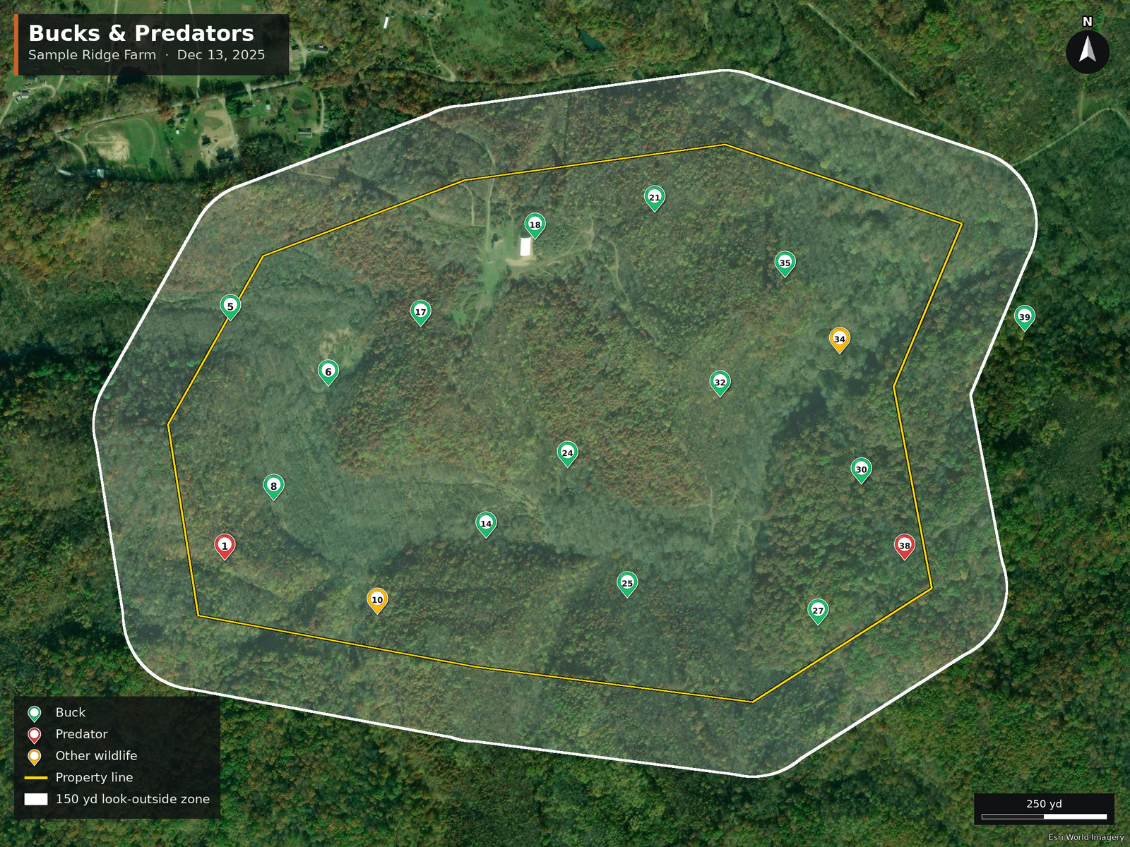
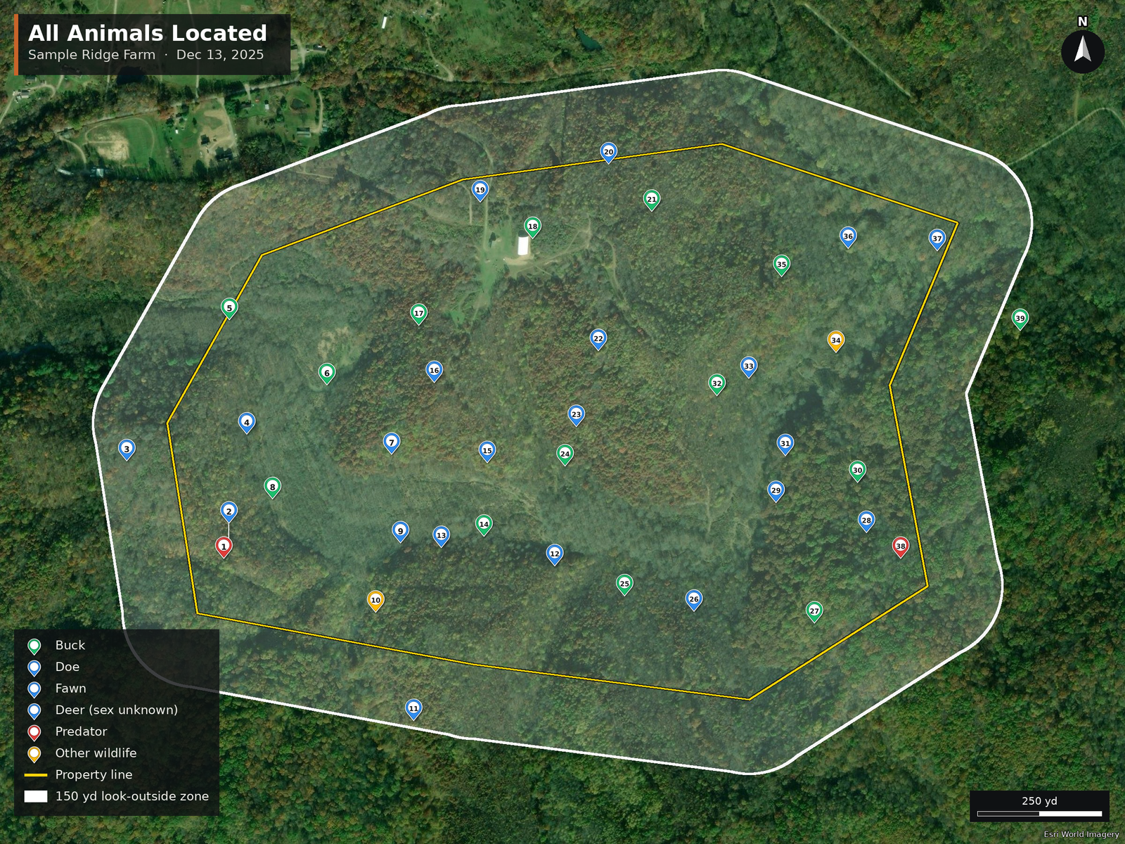
14Bucks
20Does
1 : 1.4Buck : Doe
0.50Fawns / doe
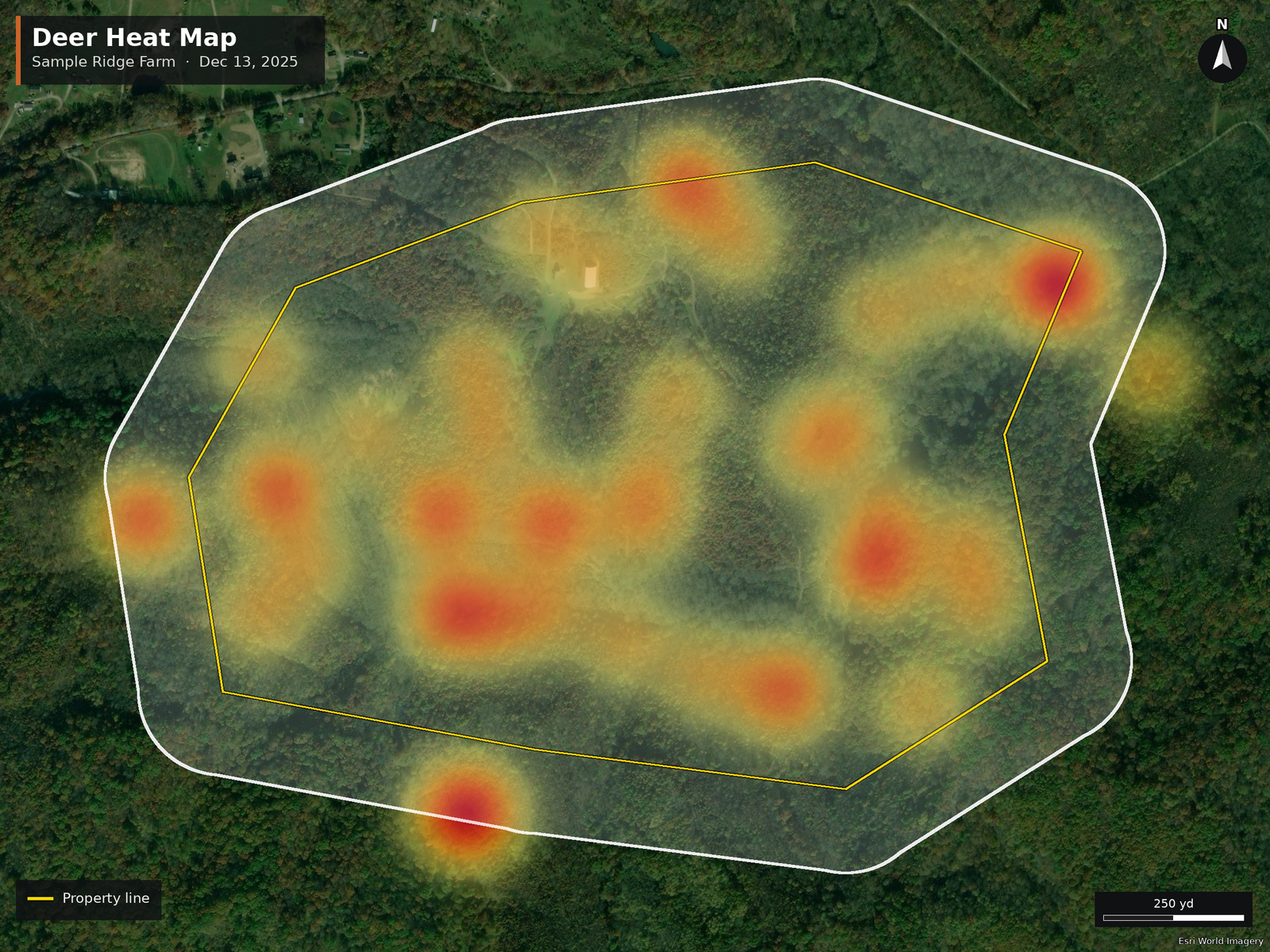
16.6Deer / 100 ac
2Predators
282.5Acres

What you get as a landowner

One thermal flight over your whole property, turned into a report you can actually learn from — where your bucks are, how old they are, your buck-to-doe ratio, and where the predators are.

Interactive map

Opens on any phone or computer. Tap any pin to see that animal's photos, antler points and estimated age. Filter to bucks only or predators only.

Open the map

The Rack Report (PDF)

  • Cover & herd summary numbers
  • Scorecard & harvest recommendations
  • Fawn recruitment (fawns per doe) & what it means
  • A page for every buck — photos, points, age
  • Predators & other wildlife
  • Property map with every pin
Read the report

Use it in your apps

Your pins come ready for onX Hunt, Moultrie Mobile, Google Earth, Garmin and more — so your stand planning lives in the apps you already use.

See the full file list on the drone-pilot side →

The maps

Tap to view full size.
Everything you deliver as a drone pilot

Run Tally Wild on your flight and it builds this entire package for you — the report, the interactive map, and a file for every app your client uses. Here's the complete hand-off, ready to download.

Start here

Plain-English guides that go to the client

  • Read me first PDFDownload
  • How to open these files PDFDownload
  • Pilot delivery guide PDF — for you, not the clientDownload

The report & map

The two things most clients open first

Hunting apps

onX Hunt & Moultrie Mobile

GPS & spreadsheets

Google Earth, Garmin, Google My Maps, Excel

  • Google Earth KMZ · photos in each pinDownload
  • Garmin / other GPS GPX · every animalDownload
  • Google My Maps KML · every animalDownload
  • Excel XLSX · animals & summaryDownload
  • Spreadsheet GPS points CSVDownload

Agency / biologist export

For a state agency or wildlife biologist

Tally Wild
This whole package is built by Tally Wild.

Learn it. Fly it. Report it. Add deer herd analysis to your drone business — the software turns your flight into everything above.

Visit tallywild.com